VAN WERT, Ohio – Van Wert County received a significant wind storm on Wednesday afternoon, according to Van Wert County Emergency Management Director Rick McCoy. The National Weather Service predicted a storm system several days ago, which resulted in tornadoes in Illinois and damaging winds in Indiana and Ohio.
As the storms approached Ohio, Van Wert County was issued a Severe Thunderstorm Warning at 5:52pm, with winds expected to reach 60 mph. McCoy had already contacted the Fire Department and Amateur Radio Weather Spotters and had them out in the county collecting reports.
He had also contacted the Countywide Parks Departments, requesting that children’s ball games be canceled due to the approaching storms.
As the storms moved into the county, local EMA weather stations along the state line reported wind gusts exceeding 50 mph and heavy rain. When the storm system approached Van Wert from the southwest, winds gusted to 59 mph at the Fairgrounds and 55 mph at the EMA office.
According to McCoy, a Microburst (intense downburst winds) appeared on the storm’s northern fringe, affecting areas east of Washington Street and north of the railroad tracks. Damage was extensive in the northeast part of the city, with many trees and power lines down.
Several homes and cars were damaged by falling trees. McCoy estimated that the microburst winds reached at least 70 mph before exiting the city and flipping a semi on US 30 near Stripe Road. McCoy stated that he received several reports of a possible funnel as it moved through the Northeast part of the city, and a video recording confirmed that the microburst was producing a gustnado.
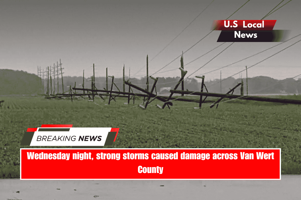
The video clearly shows the funnel on the ground moving through the area from North Walnut and Sycamore Street to North Franklin Street before crossing the road into a field and heading towards the location where 15 large transmission poles were snapped to the east of Vantage Vocational Schools.
McCoy observed that a gustnado forms differently than a normal tornado. It does not form at the thunderstorm’s base, but rather from the ground up, spinning rapidly as a result of the intense winds moving through so quickly.
Overall, McCoy stated that the strong winds damaged, snapped off, or uprooted over 100 trees throughout the city. He stated that power went out on the north side of town, forcing businesses to close.
Power outages were expected to continue overnight and into Thursday as a result of the downed transmission poles near Vantage, as well as several additional large transmission poles snapped near Trinity Friends Church.
McCoy stated that several streets would remain closed overnight due to trees blocking roadways. He also stated that railroad officials were contacted to repair RR gates that had snapped off at several crossings.
The EMA Director also reported that the bell tower at St Marys Catholic Church was flattened, as well as some structural damage to the church; a front door at the YMCA was shattered; the bell tower at St Marks Lutheran Church was damaged; and the roof of First Financial Bank was damaged.
H&R Block’s front wall has sustained damage. McCoy stated that this was the worst wind damage in Van Wert since the June 29, 2012 derecho. He stated that fortunately, no injuries were reported.